 This map shows a selection of neighborhoods that contain a shopping center in them.
 This map shows a commerical zoned area that contains a shopping center. Of course the area is zoomed in to better show the shopping area.
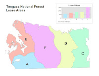
Today in class we had our second test for the semester. Since I took the first test kinda late, I haven't recieved my grade from the first test when I took the second test. Maybe next class I can get my grades from both tests. In addition to the test we also looked at chapter nine powerpoint. Mr. Kennedy did something kinda different for the powerpoint. He displayed the powerpoint on the projector as well as on all the lab computers. He did this to better show the maps that were in the powerpoint. After the powerpoint we did chapters ten, eleven, and twelve in the GTKA for lab. I now have gotten in the habit of saving the maps as jpegs so I can post them on this blog site. It is going to take about another week to get all the images from the past chapters on the site. Displaying above the blog should be the maps from chapters ten and eleven. The maps for twelve are going to be added to that in about three days.
Today in class we looked at attribute data and tables. Yes, today I was not in class due to my own fault. What can I say but I overslept and missed the entire class. I kinda wish I hadn't missed this class due to the announcement of a test next class period. The test will cover chapters 4,6,7, and 8. Assigned was also 7A, 7B, 8, and 9 lab exercises in the GIS book. At least I think that 7A and 7B were assigned. Needless to say that I am going to be doing alot of lab work Thursday afternoon and night to prep for this test. About three posts up from this one should be some maps and tables for chapter eight and nine. Chapter seven maps are coming soon.
Today in class was went off the schedule and did something different. Here is the rundown of what happened. More information was given about the GIS that AB Tech is hosting in November. Also we looked at chapter six, aerial and satellite images. The powerpoint for this chapter had alot of aerial and satellite images in it. Due to the projector in the class, we weren't able to see the images all that good. I might have to take a look at some of those images on my computer. After looking at the chapter we did a lab that the instructor has created to test our knowledge of what we have learned so far. The exercise is on the GIS blog site. The exercise allowed us to take a map of the Bent Creek area and georeference the data. Within the exercise is two fifteen minutes videos, made by the instructor, showing how to do the entire exercise. The instructor wanted the exercise not to take to long and for us not to have homework. What really happened is that me and some other classmates were having trouble with the exercise, so we have been instructed to finish it on our own time before next class. One of the issues that I was having is actually something that is very easy to remember. The rule is always "unknown to known." What really happened when I did the lab was putting known to unknown. When I did this the map started getting alittle funky. After thirty minutes of doing this, I finally fixed the issue and put "unknown to known" with the instructor's help. Hopefully by next class I will have that drilled into my head that you should always put "unknown to known."
Today in class we went over chapter four (data entry and data sources) and chapter seven (digital data). The lecture took about two and a half hours to complete due to the amount of data in each chapter. Of course there was breaks added into the lecture for us to stretch our legs and get some water. The labs we did were chapter fiftteen and chapter sixteen in the GTKA book. During lab time, the instructor announced that on November ninth AB Tech is going to have a GIS day. That is the day that all the GIS "big wigs" from the city are going to meet on the campus and have displays, geo type domes, and demos that we can destory (test). The "event" is going to be from 9am - 2pm. Since this is in our class time, our class is going to be run crowd control (I should bring my pepper spray and nightstick), having class time, and looking at all the "owe....awe" displays. I wonder how much stuff they will actually trust me to handle?
Today was our first test for the GIS class. Due to a series of events that happened this morning, I was unable to attend the test. Since we only have four test this entire semester, I either have to make up the test and receive a lower grade for turning it in late or take a zero on the test and get hundreds on the next three tests. I can decide what I would like to do but when it comes down to it, the instructor has the final say.


